The Great Lakes formed approximately 14,000 years ago as the glaciers that once covered North America began to retreat. The lake system accounts for 20% of the world's fresh water, making it the largest freshwater system in the world. It is made up of five lakes, Superior, Michigan, Ontario, Erie and Huron, and is bordered by eight states and two Canadian Provinces. The lakes are connected to each other by three rivers, St. Mary’s, St. Clair and Niagara, and the Straits of Mackinac. The St. Lawrence Seaway provides the outlet to the Atlantic Ocean. A series of locks, canals and channels allow ships up to 740 ft long to maneuver the Great Lakes.
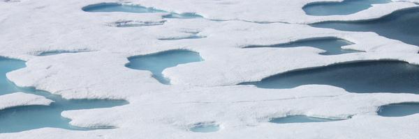
The Great Lakes are a major shipping gateway, especially for agricultural and mine products, and yet it's not unusual for Lakes Superior, Huron, and Erie to experience 70% or more ice coverage during the winter. The NOAA Great Lakes Atlas maintains daily average ice cover charts from 1973 through 2002 for Superior, Michigan, Ontario, Erie and Huron.
How does the shipping industry deal with ice? Indeed, the locks between Lake Ontario and Montreal on the St. Lawrence River do close from late December to late March because of ice, but before and after this closed season, the Great Lakes have a couple of methods to ensure that maritime commerce can continue even with ice. The United States and Canadian Coast Guards employ icebreaking tugs, vessels, and buoy tenders to cut paths through the ice. They also rely on up-to-date ice data and ice prediction charts. Both the United States National Ice Center and the Canadian Ice Service produce ice charts that use an "egg code" to explain the ice conditions.
The egg code is a unique symbol that can convey a lot of information in a compact form. The egg code is divided into four sections. The top section indicates how much ice coverage is in a certain area of the lake and is depicted in tenths. If the top number is 1, then 1/10th or 10% of the area has ice. The remaining three sections are read in columns and describe the thickness (section 2), type of ice (section 3), and the size of the chunk of ice or "ice floe" (section 4). Go to the Canadian Ice Service Egg Code page to see a detailed explanation of how to read an egg code.
In the following data activity, we will analyze actual and predicted ice charts and use them to discuss wintertime shipping in the Great Lakes.
Data Activity
>Print out the following 2002-2003 ice charts from the National Ice Center:
NOTE: You will need to use your "landscape" orientation to print the eastern lakes maps and your "portrait" orientation to print the western lakes maps. If you wish to compare the maps side-by-side on two screens, click on the icon which allows you to expand the map to regular size (it will appear on the page and will say “expand to regular size” when moused over).
How did the predicted January ice maps compare with the actual December ice maps?
How did the predicted March ice maps compare with the actual March ice maps?
Did any lakes completely freeze over?
Look at the actual ice conditions for March 27, 2003 eastern lakes and western lakes. As mentioned above, the Montreal/Lake Ontario locks open back up in late March. Imagine how much icebreaking would have been necessary to get to ports such as Duluth, Detroit, Toledo, and Cleveland.
Which major ports would be affected by the remaining ice?
Now let's look at the 2003-2004 season. Print the following maps:
How close are the 2003-2004 predictions to the actual values?
Did any lakes completely freeze over?
What is unusual about your answer to question #6, and how do you explain it?
Which ports would be affected by a frozen over Lake Erie?
Author
Lisa Ayers Lawrence, Virginia Sea Grant, Virginia Institute of Marine Science
Grade Level
8-12
Lesson Time
45 min-1.25 hr
Objectives
Vocabulary
Jetstream, Egg code
Materials Required
2002-2003 ice maps (8):
Natl. Science Standards
IK-1 IK-2 ES5-1 ES5-2 ES9-2 PS5-3 PS5-5 PS9-5 PS9-6
Join the ocean education conversation! Scuttlebutt is the national email discussion list for educators and scientists interested in talking informally about ocean education ideas, issues and questions.
All educators and scientists interested in marine science education are invited to subscribe. The Bridge staff monitors list activity and often is able to assist in locating expertise to answer questions that teachers post to the list, as needed. The list does not provide research services for students' assignments.
Scuttlebutt carries messages related to marine education that should be of professional interest to many marine educators nationwide. Petitions, political commentary or advocacy, resumes or job requests, requests for donations or votes, crowdsourcing, cross postings and commercial messages are not accepted. Please restrict attachments to a total size of 500kb or less.
Copyright © 2022 - All Rights Reserved - the BRIDGE
Template by OS Templates